|
"To put
it in very basic terms, we measure the depth of water," says John,
40. But, of course, there is a lot more than that to charting the
oceans.
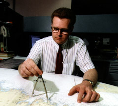
John
works for the Canadian Hydrographic Service (CHS) offices housed
at the Bedford Institute of Oceanography in Dartmouth, Nova Scotia.
He
spends two months a year (usually May and June) on board the 50-metre
Canadian Coast Guard Ship Matthew collecting data, and the rest
of the year processing, cleaning up, and archiving the information.
The CHS uses the data to produce nautical charts that every vessel
over a certain size must carry while in Canadian waters.
John's
team of six hydrographers covers all of Atlantic Canada and Labrador.
On the water, four staff members conduct sounding operations from
the Matthew itself, while two others go out in a pair of 10-metre
fiberglass launches.
The advent
of multibeam echo sounders in the late 1980s has meant that hydrographers
can get a much more complete picture of the ocean floor than was
previously possible. Sometimes they return to some already charted
areas in order to collect more detailed data.
They frequently
find dangerous inaccuracies in current charts. "Often times we
find areas much shallower than an existing chart might show and
we have to get that out to the public in an expeditious way,"
John explains. Although he still gets seasick, John says the two
months spent annually in the field are by far the best part of
the job. "We're always in remote areas of the country and there's
not a whole lot of civilization - so it has this frontier feel
to it," he says. "Flying around in helicopters is kind of neat
too."
|
 |