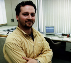
Keeping track of an ambulance that's speeding to save a life, fighting
forest fires from a distance, predicting the size of the annual wheat
harvest - what do all of these activities have in common? They all involve
applications of geomatics, the science of gathering, storing, analyzing,
circulating, and managing data on a given territory. None of this could
be done without the important work performed by Geographic Information
Systems (GIS) Technologists like Steve Perron. |
 |
 |
|
Steve, 25, is a Programmer-Analyst for Groupe-Conseil DMR in Quebec
City. His job, a combination of computer science and cartography,
involves developing computer systems used for land management. He
works on various contracts for his employer's clients, such as government
agencies.
In the Forestry Division of the Quebec Ministry
of Natural Resources where he's currently working, Steve is in
charge of developing a computer system that will perform a systematic
update of maps showing all of the forested areas in Quebec. "These
are digitized maps which the Ministry keeps for reference," he
explains. "The maps must be updated on a regular basis to provide
an accurate picture of forested areas."
Steve spends the better part of his days programming
at the computer. He seldom works alone - generally, he coordinates
his work with a team of designers. "I may do the programming on
my own, but we all consult each other, since my work is interrelated
with what the other designers do. It's a good thing I like teamwork!"
|
 |
| |
|
|